|
Knox County ILGenWeb |

|
|
[Contributed by Todd Walter.]
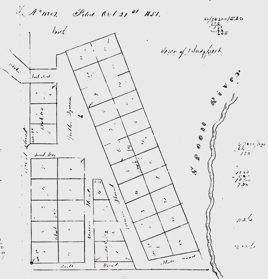
The Town of Bridgeport is laid out on the South half of the South East quarter of Sec No. Twenty three in Township No. Nine North of Range No. Two East of the 4th principal meridian. The survey of which was commenced on the 16th of October and completed on the 17th of October, 1851. Commencing at the South _ _ _ corner of said _ _ _ _ _ thence East along the south boundary of said quarter _ _ _ _ _ the South Side of South Street is bounded by the South line of the quarter. The lots in Block No. One are each 100 feet long by 80 ft. wide and contain 18/100 acres except Lots No. 1 & 22 which are each 100 ft on the South & Lot No. 1 is 80 feet on the West. The North side of the lots is at Right angles with Main Street which runs Northwest. The lots in Block No. 3 are each 100 ft long by 50 ft wide. The lots in Block No. 4 are each 80 ft long by 50 ft wide. The lots in Block No. 2 are each 80 ft wide on the West are bounded on the East by Main Street. The South side of lot No. 1 is 160 feet and the North side of lot No. 4 is 30 ft. Main Street is 66 ft wide. Union Street and West Street are 33 ft wide. Broadway and North Street are 66 ft wide. State of Illinois Knox County }
In _ _ _ _ _ of _ _ _ _ _ in such case made and provided, I Andrew Parker of Knox County in the State of Illinois, proprietor of the town of Bridgeport in said County do hereby establish said town as laid out in the within plat and survey thereof as certified by the County Surveyor and I do hereby grant all streets and alleys in said town as laid down in the within plot and survey to be and forever remain public Streets & Alleys in said Town. In witness whereof I have hereunto set my hand and seal this twenty first day of October in the year of our Lord One thousand Eight hundred and fifty one. In presents of Wm. M. McGowan
[Contributed by Bob Miller.] From the 1870 Atlas Map of Knox County, Illinois, Andreas, Lyter & Co., Davenport, Iowa, 91 pages. "Bridgeport was laid out in 1852, by Andrew J. Parker, but failed to make a town of any note." |